Gascoyne River Catchment Management
The Gascoyne Development Commission is working with land managers across the Gascoyne River catchment to improve productivity and enhance natural capital.
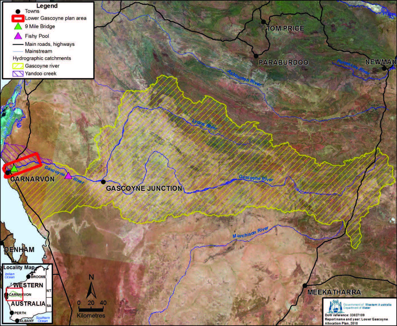
The Gascoyne River is located in the Gascoyne Region of Western Australia with its catchment being one of the largest in WA encompassing some 79,000km2 of land. It is made up of highly sensitive riparian areas, primarily containing low refile land and natural vegetation of open low woodland savannahs. The catchment extends inland some 760km from Three Rivers Station to the coastline of Carnarvon.

Gascoyne River Catchments Map (Image courtesy of the Department of Water)
The health of the river and its catchment is key to ensuring its long-term prosperity and the success of those reliant on its natural resources of water and biodiversity.
The river and its catchment support a number of towns and communities which are valuable to both the Gascoyne Region and the Western Australian economy. Various industries are also reliant on the river health, including the Horticultural Industry of Carnarvon, Pastoral Industry, Fishing Industry, local communities and vibrant growing tourism sector.
The Gascoyne River catchment supports the pastoral industry which is the predominant land use in the region. For pastoralists it is more than just an industry, it is a lifestyle choice (with a rich cultural history specifically for both Traditional Owners and pastoralists). Across the region (not just the catchment) the value of pastoral industry to the WA economy was $30m in 2015.
The horticultural industry lies at the mouth of the Gascoyne River and was valued at $94m in 2019. This industry is reliant on the river for irrigation, whether that be directly from flowing water or the aquifers which when the river flows are recharged.
The Gascoyne River also supports the fishing industry. Fishing in the Gascoyne region was valued at $43m in 2015 contributing to 9% of the WA total fishing value.
The catchment and its waterways cover a vast area of biodiversity and cultural assets which includes Kennedy Range and Mt Augustus National Park and a large amount of Exclusive Native Title Estate.
The river brings with it many benefits, but it can also have devastating impacts. The flood in early 2021 caused major road damage, loss of topsoil in both the pastoral area and the horticultural precinct plus damage to food crops in the horticultural precinct. The damage bill from this flood was valued at over $30 million. The flood in 2010 was estimated at over $90 million.
Climate projections for the Gascoyne area are that annual rainfall will decrease and become more variable, temperatures will increase with increased hot spells and increased intensity of extreme rain events leading to high risks of increased soil erosion and impacts downstream.